Table of Contents
Get our free local reporting delivered straight to your inbox. No noise, no spam — just clear, independent coverage of Marblehead. Sign up for our once-a-week newsletter.
Marblehead’s usually blue summer sky took on an eerie orange cast Wednesday morning as wildfire smoke traveled hundreds of miles into New England.
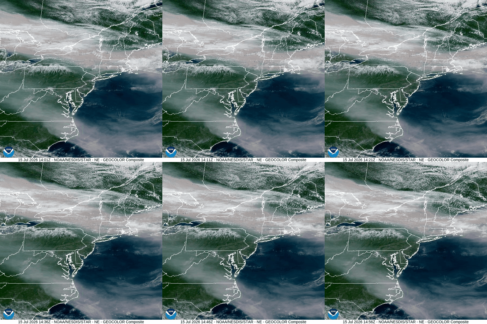
The discoloration was not caused by a nearby fire. Regional forecasts and federal satellite analysis point to smoke from wildfires burning across several Canadian provinces, including Ontario, Manitoba and Saskatchewan. Winds carried the smoke southeast into the northeastern United States.
Smoke particles suspended in the atmosphere filter and scatter sunlight, muting blues and allowing orange and red wavelengths to become more prominent. Even smoke located high above the ground can tint the sky, dim the sun and produce unusually vivid sunrises and sunsets.
The National Weather Service’s Boston office said a new plume was expected to shift south into the region Wednesday in greater concentrations, with some of the smoke reaching close enough to the surface to be smelled. The haze was also expected to hold temperatures slightly below earlier forecasts by limiting the amount of sunshine reaching the ground.
The smoke was affecting more than the view.
AirNow’s live national map listed the Essex, reporting area at an Air Quality Index of 130 late Wednesday morning. That falls in the orange category, classified as unhealthy for sensitive groups. The reading is regional rather than specific to Marblehead and can change from hour to hour.
People with asthma or other heart and lung conditions, older adults and children should reduce prolonged or strenuous outdoor activity when the index is between 101 and 150, according to federal air-quality guidance. People who experience coughing, wheezing, shortness of breath, chest discomfort or unusual fatigue should move indoors and reduce their exposure.
Conditions are not expected to clear immediately. Marblehead’s forecast calls for continued haze Thursday, with wildfire smoke potentially causing reduced air quality before a chance of thunderstorms later in the day.
NOAA satellite analysts reported Tuesday night that moderate-density smoke stretched from central Canada into the northeastern United States, while a lighter layer covered much of the country. The agency cautions that satellite images show smoke in the atmosphere but do not necessarily reveal how much of it has descended to breathing level.
The orange sky may be visually striking, but residents should check current air-quality readings before exercising, working or allowing children to spend extended periods outside. Air quality can vary significantly as winds shift and different layers of smoke move through the region.