Table of Contents
Get our free local reporting delivered straight to your inbox. No noise, no spam — just clear, independent coverage of Marblehead. Sign up for our once-a-week newsletter.
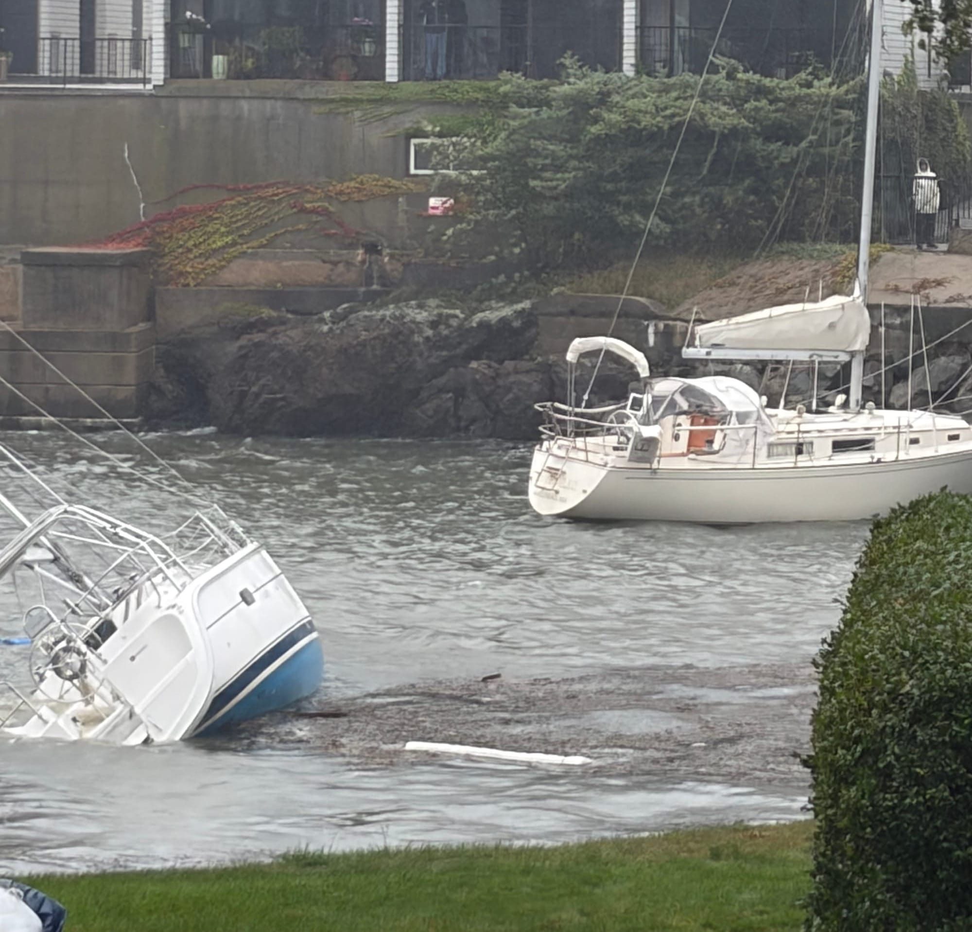
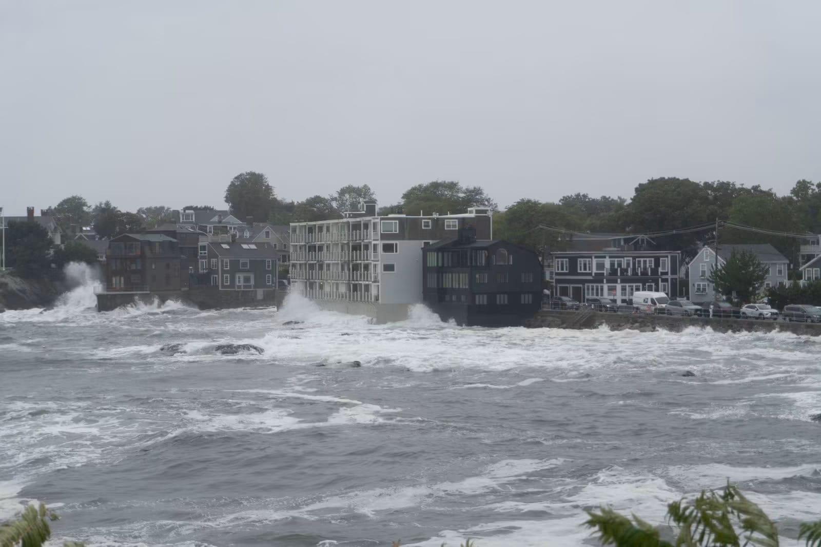
Marblehead awoke Sunday to find at least five boats loose from their moorings and more capsized in the harbor, one of the loose boats tipped on its side beneath a seawall at Glover Landing, the condominium complex on Skinners Path.
By about 10:50 a.m., more than an hour before the midday high tide, spray was starting to come over the Ocean Avenue causeway.
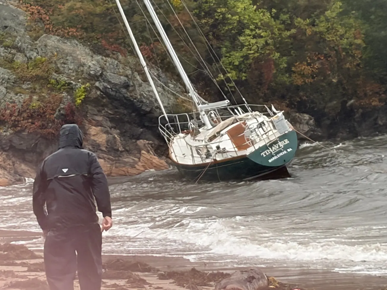
At Riverhead, a sailboat sat aground on the beach below the rocks, heeled over on its dark green hull as waves broke around it. Three small power boats were also loose there. Many more boats had capsized but stayed on their moorings.
At Glover Landing, a sailboat lay heeled far over on its blue hull while a second sailboat sat upright close to the rocks. Two people watched from a balcony above.
The day before, dozens of sailboats and motorboats in Marblehead Harbor had pitched hard at their moorings in water chopped white by the wind, and the storm seemed to be falling short of its billing.
A quieter Saturday than forecast
Going into the weekend, the National Weather Service's surf advisory called for breaking waves of up to 17 feet. For Saturday's midday high tide, it forecast 12.1 to 12.6 feet at Boston Harbor, the nearest official gauge to Marblehead, with 2 to 2.5 feet of storm surge.
The water did not follow the script. Saturday's tide peaked at 11.66 feet around 11:42 a.m., according to preliminary data from the National Oceanic and Atmospheric Administration (NOAA). That was below the 12.5-foot minor flood stage and short of even the low end of the forecast. The surge ran about 1.45 feet. The worst flooding showed up to the south, where about 2 feet of surge pushed Nantucket into minor flood stage Friday night.
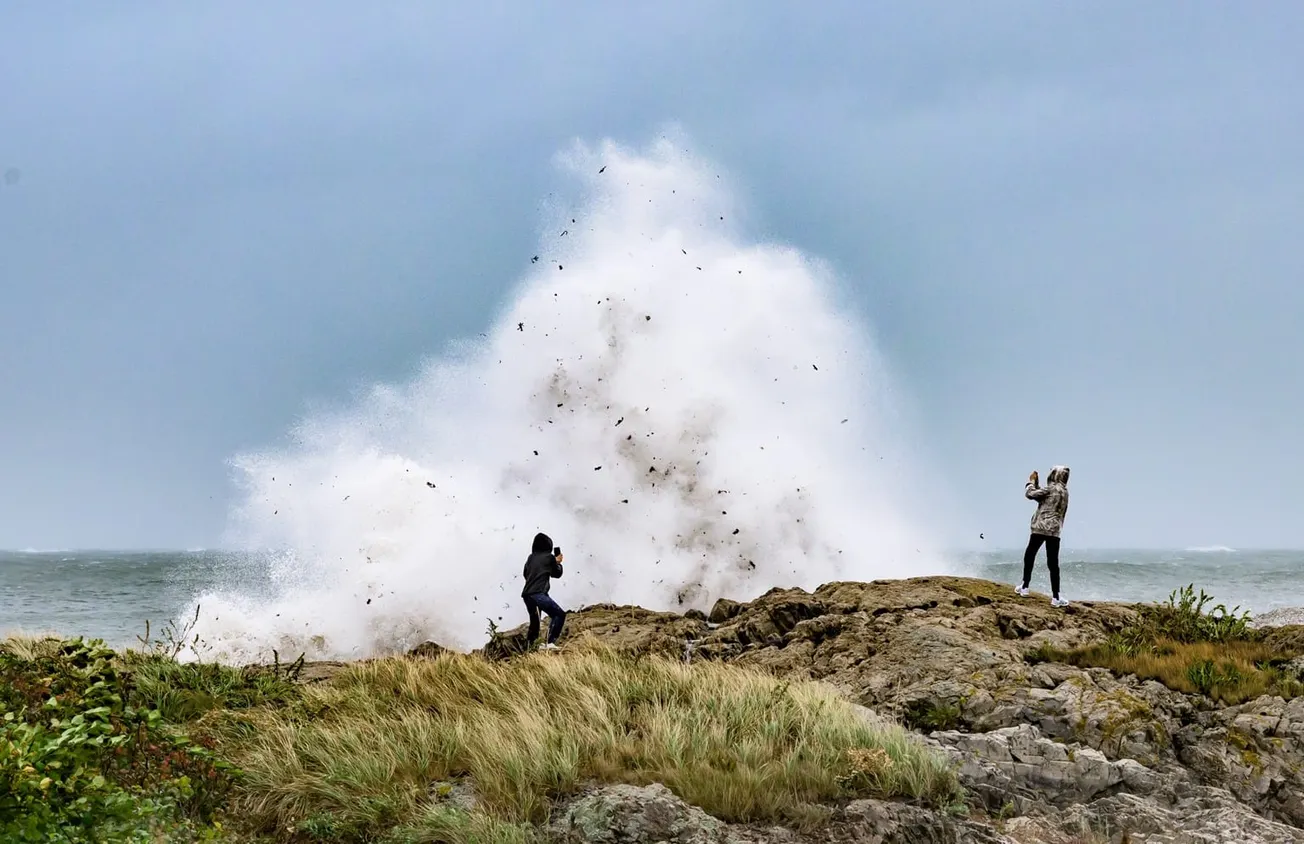
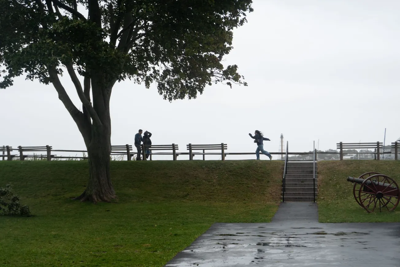
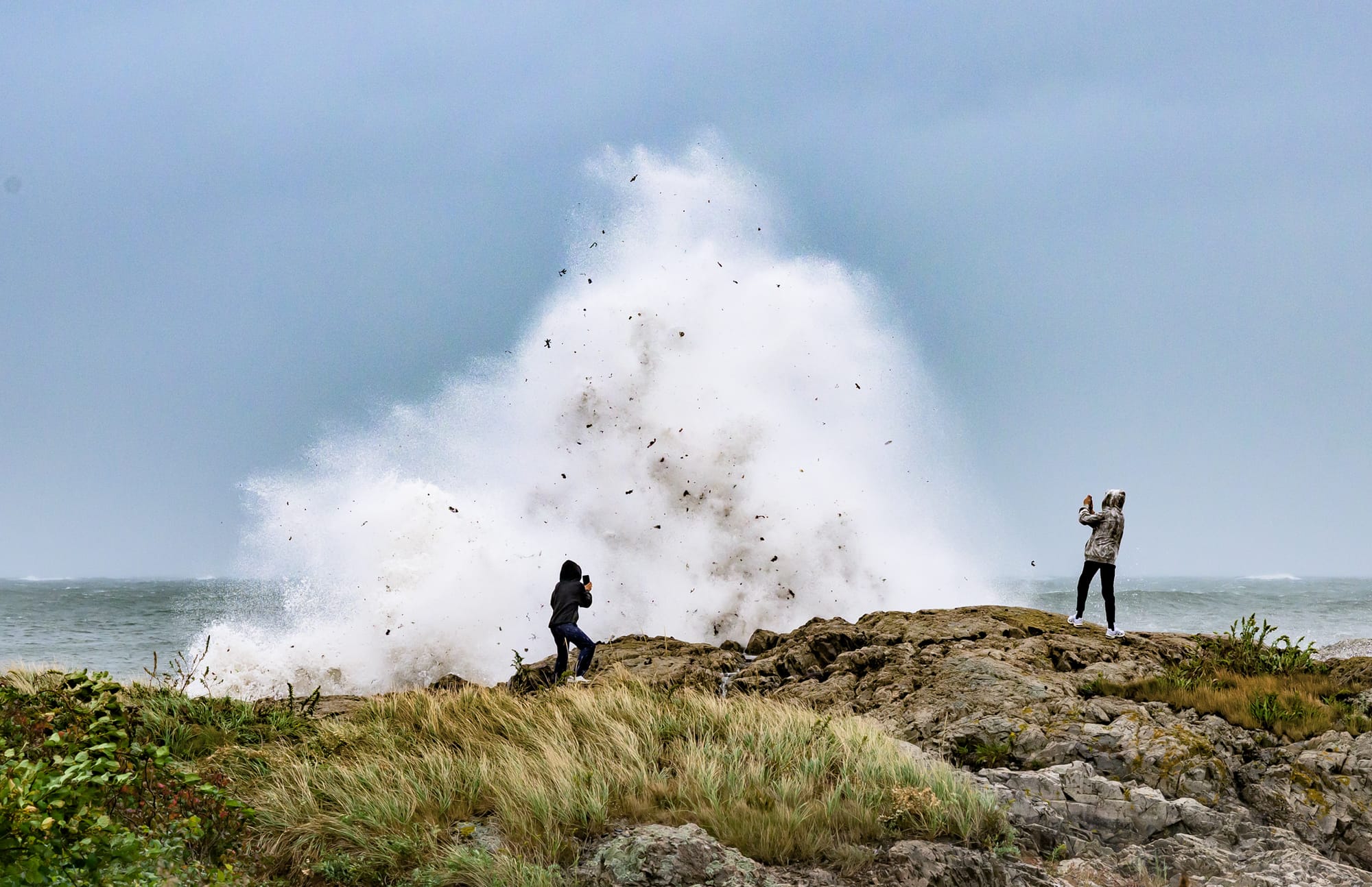
The town came out to watch anyway. At Chandler Hovey Park, waves hammered the rocks below Marblehead Light and threw spray and debris into the air. Along Ocean Avenue, families in rain jackets stood in beach grass beside the causeway as waves broke just beyond the seawall. At Devereux Beach, surf and sea foam pushed inland around the pavilion, sending adults and children running. Brown School Principal Mary Maxfield stopped to take a selfie with the surf behind her.
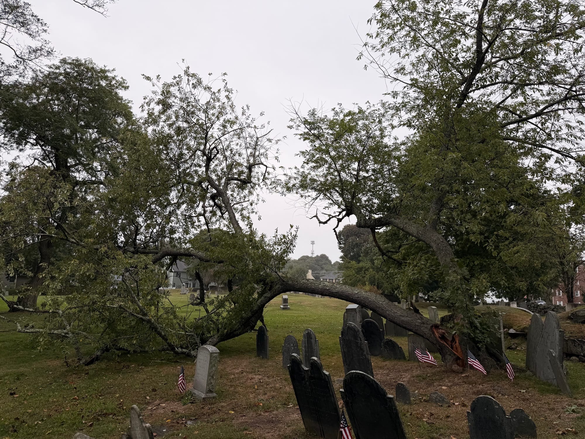
The day's clearest damage came at Green Street cemetery, where a tree snapped near its base and its canopy collapsed across rows of slate headstones marked with small American flags.
By late afternoon, Fire Chief Jason Gilliland had noticed the gap between the forecast and the harbor, but he wasn't ready to call it.
"Right now I haven't seen much of anything," Gilliland said in an interview at 5:34 p.m. "I'll reserve judgment for later."
He remembered the 17-foot wave forecasts and the crowds at the town's grocery stores before the storm.
"You look at Crosby, you look at Market Basket, you think there's a snowstorm coming," he said. "Here we are Saturday. We had some wind, but not crazy winds."
Tide stops short, wind lingers
The weather service was not backing off. At 2:08 p.m. Saturday, it raised its surf forecast to breaking waves of 6 to 15 feet and warned of renewed 45 to 60 mph gusts overnight. The harbormaster told Gilliland that if conditions turned bad, it would be around the midnight high tide.
Just after midnight, the Boston Harbor gauge reached 12.13 feet, the highest reading of the storm so far and about 4 inches short of flood stage, according to NOAA. The storm added about 1.8 feet of water to that tide, more than Saturday's surge but less than the weather service had forecast. In its 7:59 a.m. forecast discussion Sunday, the weather service said Boston and Nantucket both stayed under flood stage overnight.
By early Sunday, the weather service had canceled the high wind warning, saying the storm's center was drifting west into New Jersey and taking its strongest winds with it. Forecasters expect northeast gusts of 30 to 40 mph Sunday, easing below 30 mph by Monday night.
On the shore, it did not feel finished. Late Sunday morning at Riverhead, gusts were strong enough to nearly knock a person off their feet.
Sunday's midday tide, due around 12:12 p.m., is predicted at 10.62 feet before storm surge, according to NOAA. With the surge running about 1.5 to 1.6 feet Sunday morning, the peak would land near 12.1 to 12.2 feet, just under flood stage.
The coastal flood warning and the high surf advisory run until 8 p.m. Sunday. The warning calls for up to 1 foot of water above ground in low-lying areas near the shore and severe beach erosion. It cautions that water may struggle to drain as northeast winds keep pushing in. As of its latest alert, the weather service had not extended the warning into Monday, though it said minor flooding remains possible into Monday.
The flood watch continues through 2 a.m. Tuesday, with 2 to 4 inches of rain expected and localized totals of 5 to 7 inches possible. Offshore, gale warnings run as late as 8 p.m. Sunday, with seas of 10 to 14 feet easing to 6 to 10 feet by Sunday night.
Causeway and Monday's tide
As of about 10:40 a.m. Sunday, the town's website had posted no road closures, no causeway closure, no parking ban and no outage notices. Its most recent storm notice, from Sept. 24, warns that the causeway, the only road in and out of Marblehead Neck, may close with little notice if flooding, crashing waves or debris make crossing dangerous. Residents should also watch Front Street, Beacon Street and the Grace Oliver's area for flooding.
The causeway was Gilliland's main concern Saturday. As one of the town's two emergency management directors, the decision to close it rests largely with him. If waves throw debris onto the road, he said, public works crews would have to come out and scrape it clear.
Jonathan Blair, general manager of the Marblehead Municipal Light Department, said the town coordinated Thursday afternoon to line up its storm response across the Police, Fire, Public Works, School and Tree departments.
"So far, so good," Blair said in a text message Saturday. "We're definitely not out of the woods yet, but we are stocked and staffed for whatever comes up."
Forecasters expect marked improvement Tuesday, followed by mainly dry weather and a warm-up into the mid- to upper 70s late in the week.
Before then, the water gets one more turn. Monday's midday tide is predicted at 10.92 feet around 12:51 p.m., higher than either weekend midday tide. About 1.6 feet of surge would carry it to flood stage, roughly what the Boston gauge was showing as the water came in Sunday morning.
When boats break loose in the harbor, you need news about Marblehead, not all of Massachusetts. The Independent was out at Riverhead and Glover Landing Sunday morning so you could see what the storm left behind without leaving the house. That reporting is free to read for the whole town because members pay for it. If this story helped you, become a member today and help keep independent local reporting going through this storm and the next one. 🟦 Become an Independent member here.