Table of Contents
Get our free local reporting delivered straight to your inbox. No noise, no spam — just clear, independent coverage of Marblehead. Sign up for our once-a-week newsletter.
Saturday's midday high tide came in lower than forecast, with no minor flooding. But the National Weather Service issued a flood watch for eastern Massachusetts early Saturday afternoon, and the storm's strongest winds for Marblehead have not arrived yet.
The high tide at Boston Harbor, the nearest official gauge to Marblehead, peaked at 11.66 feet around 11:42 a.m., according to NOAA Tides & Currents. That was below the 12.5-foot minor flood stage and short of the weather service's forecast of 12.1 to 12.6 feet.
"So far, so good," Jonathan Blair, general manager of the Marblehead Municipal Light Department, said in a text message Saturday. "We're definitely not out of the woods yet, but we are stocked and staffed for whatever comes up."
Blair said the town coordinated Thursday afternoon to line up its storm response across town departments.
What happened versus the forecast
The storm surge, the extra water pushed ashore by the storm, ran about 1.45 feet at the midday tide. Forecasters had expected 2 to 2.5 feet.
Before that tide, the weather service's 8:04 a.m. forecast discussion said the storm was playing out largely as expected. Farther south, about 2 feet of surge pushed Nantucket into minor flood stage during the overnight high tide.
The wind has hit hardest to the south so far. Gusts of 45 to 55 mph were widespread overnight from Cape Cod and the islands to coastal Rhode Island, and several coastal stations reported gusts above 60 mph, according to the weather service.
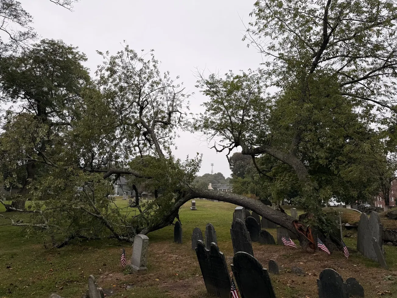
Marblehead has already seen damage. A tree fell at Green Street cemetery, splitting near the ground.
What is still coming
The next high tide, just before midnight Saturday, and Sunday's midday tide are both still forecast at or near minor flood stage. The weather service expects 12.4 to 12.9 feet tonight and 12.3 to 12.8 feet Sunday. If the surge holds near 1.5 feet instead of 2 to 2.5 feet, both tides could come in near or just under the 12.5-foot threshold rather than clearly above it.
NOAA's tide predictions show why Sunday matters. Before any storm surge, Sunday's midday tide is predicted to reach 10.62 feet, higher than Saturday's 10.21 feet. That means it would take only about 1.9 feet of surge to reach flood stage Sunday, compared with about 2.2 feet tonight.
Forecasters said the east coast of Massachusetts, especially south of Boston, remains the area of greatest concern. Winds will keep blowing from the northeast for a long stretch, water may not fully recede between high tides, and the astronomical tides are rising through the weekend. The coastal flood warning, which calls for minor flooding with pockets of moderate flooding, remains in effect until 8 p.m. Sunday. A high surf advisory for breaking waves of 6 to 13 feet runs through the same time.
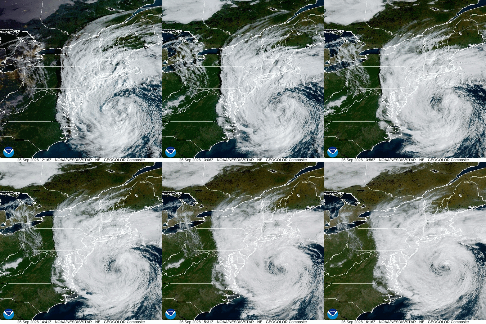
The storm's center is moving slowly north and is expected to turn sharply west into New Jersey tonight into Sunday. As the strongest winds move north and west with it, forecasters expect the peak gusts in northeastern Massachusetts later Saturday into Sunday. The high wind warning, which calls for gusts of up to 60 mph, remains in effect until 8 a.m. Sunday. It warns that damaging winds will bring down trees and power lines and that outages are expected.
Rain is now its own concern. The flood watch issued at 12:18 p.m. Saturday runs through 2 a.m. Tuesday. Forecasters expect 2 to 4 inches of rain across the region, with localized totals of 5 to 7 inches possible, and warn that urban streets and small streams could flood. Marblehead is expected to get 3 to 5 inches through Monday.
Town status
As of Saturday midday, the town had not closed the Ocean Avenue causeway or any other roads, and the light department had not posted any outage notices.
The town's standing warning remains in place. The causeway, the only road in and out of Marblehead Neck, may close with little notice. Residents should also watch Front Street, Beacon Street and the Grace Oliver's area for flooding.
What comes next
The high wind warning ends at 8 a.m. Sunday. The coastal flood warning and high surf advisory end at 8 p.m. Sunday, and the flood watch continues through late Monday night. Forecasters expect drier, warmer weather starting Tuesday.
The next test for the waterfront comes just before midnight.
When the causeway floods or the power goes out, you need news about Marblehead, not all of Massachusetts. The Marblehead Independent is covering this storm street by street, and it's free to read because members pay for it. If this story helped you get ready, become a member today and help keep independent local reporting going through this storm and the next one. Click here to become an Independent member.