Table of Contents
If this kind of grounded local reporting is useful to you, join the neighbors who keep it going and help us. 🟦 Become a member here.
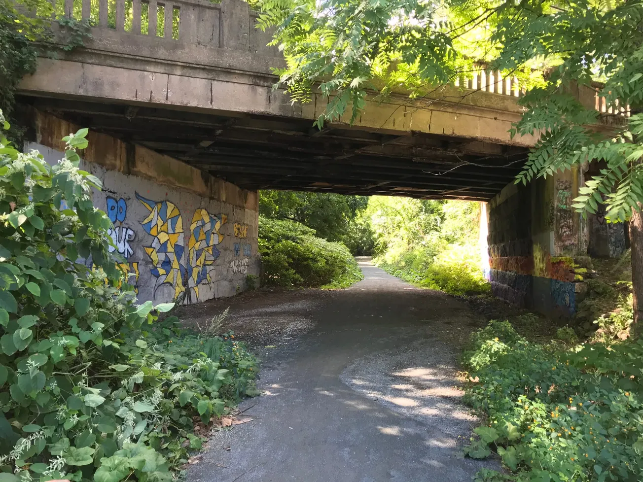
After years of planning sessions, design reviews and a single ribbon-cutting on a 650-foot showcase stretch, the Marblehead Rail Trail is entering the phase where the big decisions get locked in — and residents have one more chance to shape them before engineers close the book on the current design.
That chance comes Monday, April 27, at 7 p.m., when the town and its consultant host a virtual community meeting on the trail’s Salem and Swampscott branches. The “Moving Forward” session, held over Zoom (Meeting ID 882 3297 8388; passcode 306214), will walk residents through two significant design changes — a decision to pave a long stretch of the Salem Branch and a redesigned West Shore Drive crossing — and gather feedback before the project advances into environmental permitting, a process now on a timeline that points toward construction in 2028.
The meeting is being run by the town’s Department of Community Development and Planning and Toole Design, the project’s consultant. The flyer invites residents to learn about the project, share what they know about the trail and offer thoughts on the design.
Department of Community Development and Planning director Brendan Callahan said in an email the two branches have reached a specific engineering threshold.
“The Salem and Swampscott Branch are in the 75% Design and Permitting phase,” Callahan said.
The first of the two design changes is a decision to pave the Salem Branch between West Shore Drive and Lead Mills, a shift the project team tied to the Marblehead Municipal Light Plant resiliency project, which is burying utility wires along the corridor.
“Because of underground concrete vaults located approximately every 200-300 feet along the Salem Branch segment, from West Shore Drive to Lead Mills, the project team decided to pave this section of the trail. Paving will help mitigate potential trip hazards and erosion issues that could arise where concrete vault pads meet the natural trail surface,” Callahan said.
Get our free local reporting delivered straight to your inbox. No noise, no spam — just clear, independent coverage of Marblehead. Sign up for our once-a-week newsletter.
The West Shore Drive crossing is also getting a redesign.
“The new plan includes a dedicated bike lane through the crossing to improve safety for on-road cyclists, a concern that has persisted since the crossing was last reconstructed several years ago,” Callahan said.
A Y-shaped trail with deep roots
The Salem and Swampscott branches form the two arms of a Y-shaped trail that runs 3.34 miles through town. The Salem Branch links the old station area near Bessom Street to Lafayette Street, where it meets the Salem Bike Path, passing the 10-acre Hawthorn Pond Conservation Area and the 34-acre Wyman Woods Conservation Area along the way. The Swampscott Branch runs nearly 2 miles from the same junction past Marblehead High School — where students use it as a commuter route — and a side path to the 9-acre Ware Pond Conservation Area before ending at Seaview Avenue at the Swampscott line, where it connects to the Swampscott Rail Trail.
The corridor carries a long history. The Eastern Railroad opened a spur to Marblehead in 1839, a year after launching service between Boston and Salem. The Boston & Maine Railroad bought the line in 1890 and ran the Marblehead branch until 1959.
Monday’s session asks residents to weigh in on the current plan, though Callahan noted that public input has already left its mark on what engineers will show.
“Much of the current design reflects recommendations from the 2020 Rail Trail Plan and input from previous public and stakeholder meetings, so community feedback has already played a key role,” Callahan said.
The meeting itself is structured to move beyond a one-way presentation.
“The meeting will be primarily informational, but we also want to hear residents’ feedback on the current design. This includes their thoughts on the paving, as well as any design elements they feel may have been overlooked before we finalize the 75% design phase,” Callahan said.
The branch work has been advancing alongside a built example. The Pleasant Street-to-Smith Street “showcase” segment opened with an Aug. 26, 2025 ribbon-cutting, a 650-foot improved stretch that widened the trail to 11 feet where possible, added 2-foot grass shoulders and installed green stormwater infrastructure. That work cost $143,395 and was completed by Raffaele Construction.
The town has secured $792,657 for the Salem and Swampscott design phase, with $311,919 remaining. In May 2024, the Select Board approved two Toole Design contracts tied to that work: $378,684 for design and construction documents from the Salem line to West Shore Drive, and up to $162,000 for preliminary design from the Swampscott line to Smith Street. On Nov. 5, 2025, the board approved two more rail-trail design change orders with Toole that pushed contract completion dates to Dec. 30, 2026.
“The design contracts were extended to accommodate additional stormwater design and permitting work that was not included in the original scope of work,” Callahan said.
The road to construction
From here, the schedule tightens into a series of named targets. The 75% design phase is expected to wrap up this spring. Permitting is scheduled for winter 2026-2027, with 100% design and a bid package targeted for winter 2027-2028, pending funding. Construction is anticipated in spring-summer 2028, contingent on securing additional design and construction dollars.
The next wave of public engagement will shift from design sessions to environmental review under the Massachusetts Environmental Policy Act (MEPA).
“Key milestones for residents to watch for include public meetings related to environmental permitting for the project. The Salem Branch must undergo the MEPA process, which requires state agencies to assess environmental impacts and make informed decisions,” Callahan said.
A third segment is also on the horizon. Design is expected to begin this summer on the Wye Junction Connection, which runs from the Bessom Street trailhead south along the Swampscott Branch to Pleasant Street, then east along the Salem Branch to West Shore Drive. Funding comes from a federal earmark secured through U.S. Rep. Seth Moulton’s office via the Community Project Funding program, a state match from the Massachusetts Department of Transportation and support from the Boston Metropolitan Planning Organization, secured through the town’s Department of Community Development and Planning.
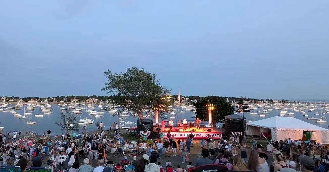
The trail is also about to get wider recognition. The Marblehead Rail Trail has been selected as one of 10 signature trails featured in the MassTrails 10 2026 campaign, a joint effort by the state Department of Conservation and Recreation (DCR), the Massachusetts Department of Transportation, the Massachusetts Office of Travel and Tourism, the Massachusetts Office of Outdoor Recreation and HUBLUV. The campaign is expected to launch through DCR in mid-to-late May. The local trail is also part of the developing Border to Boston Trail, a 70-mile network that will eventually run from the New Hampshire state line to Boston, and of the broader East Coast Greenway, a planned trail system stretching from Maine to Florida.
Town Administrator Thatcher Kezer previewed the MassTrails 10 recognition at the Select Board’s Wednesday meeting, telling members the designation will strengthen Marblehead’s position in future grant applications as the project advances. He described the selection as part of a high-visibility advertising push meant to draw attention to the state’s trail network, and credited a broader group of town departments — the Department of Public Works, the Marblehead Municipal Light Plant and the town’s water and sewer operations — for working alongside planning staff on the corridor.
Get our free local reporting delivered straight to your inbox. No noise, no spam — just clear, independent coverage of Marblehead. Sign up for our once-a-week newsletter.


